Atmospheric Violence: 285 km/h Super Typhoon Bavi Deepens to 901 hPa on Direct Collision Course with Rota

Aderson Aiden
July 5, 2026
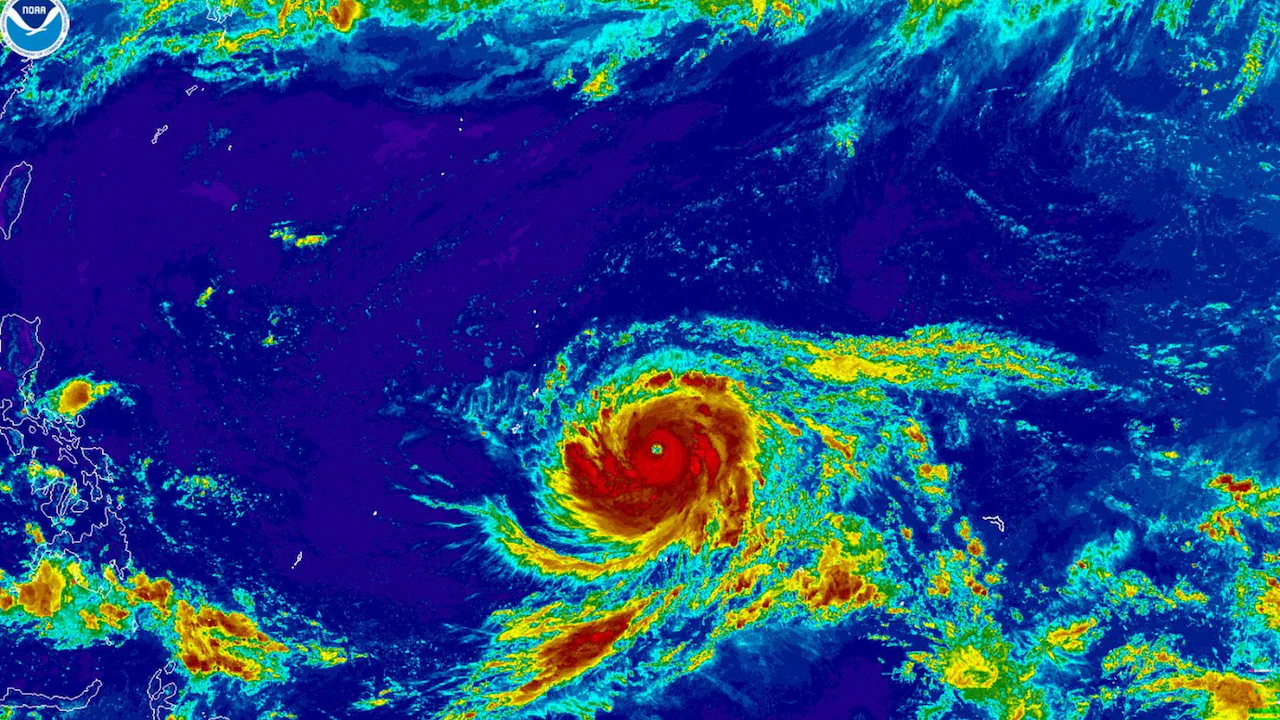
The most terrifying meteorological event of the year is unfolding in the western Pacific Ocean. On July 6, 2026, an imminent Super Typhoon Bavi Rota strike forced emergency management officials to issue final, life-saving shelter orders. The storm has undergone a jaw-dropping phase of rapid intensification. Specifically, it has reached maximum sustained winds of 285 km/h (180 mph). This explosive growth has dropped its central pressure to a staggering 901 hPa. Consequently, Bavi now ranks as a scale-topping, high-end Category 5 equivalent cyclone.
The extreme core of the system is tracking directly toward the island of Rota in the Commonwealth of the Northern Mariana Islands (CNMI). Because the eyewall is projected to hit within the next few hours, local authorities warn that conditions will deteriorate rapidly.
A Catastrophic Left Turn Puts Rota in the Crosshairs
Initially, international computer models predicted that Bavi would drift safely north of the primary civilian hubs. However, a sudden, short-term westward jog completely altered the storm’s trajectory.
As a result, this unexpected directional shift has placed the tiny island directly in the path of the storm’s most violent right-front quadrant:
- Extreme Wind Threat: Sustained winds of 285 km/h are fully capable of defoliating entire forests. Furthermore, these gusts can completely rip apart reinforced concrete roofs.
- Unprecedented Pressure Drop: The plunge to 901 hPa signals an incredibly tight, highly efficient atmospheric engine. This makes it one of the deepest typhoons documented globally in recent years.
- Fragile Infrastructure: Crucially, Rota is still recovering from the structural scars left by Super Typhoon Sinlaku back in April. Therefore, the local power grid remains profoundly vulnerable to complete collapse.
Marine Inundation and Biblical Rainfall Projections
The Joint Typhoon Warning Center (JTWC) and the National Weather Service (NWS) in Guam have expanded their highest-tier warnings. Because the storm is moving at a relatively steady pace, the destructive core could linger over land for several hours.
| Impact Category | Projected Metric Severity | Expected On-the-Ground Consequences |
| Peak Wind Gusts | Up to 340 km/h (211 mph) | Near-total destruction of non-reinforced civilian shelters. |
| Minimum Pressure | 901 hPa (mb) | Severe structural strain; indicative of a historically tight core. |
| Storm Surge Influx | 4 to 6 meters (13–20 feet) | Catastrophic coastal inundation across low-lying harbors. |
| Deluge Accumulation | 300 to 500 mm (12–20 inches) | Widespread, life-threatening mudslides and flash flooding. |
Furthermore, offshore wave heights have already crossed a monstrous 15.8 meters (52 feet). This massive sea swell will crash heavily against Rota’s northern and eastern cliffs, entirely reshaping the local coastline.
Emergency Operations Face a Closing Window
Volunteer networks and rescue groups, including World Central Kitchen, have spent the weekend racing to secure emergency food and water hubs. However, the window for safe outdoor preparation has officially closed.
“This is a worst-case scenario for Rota,” an emergency management director stated from a reinforced bunker. “Therefore, anyone who has not sought shelter inside a solid concrete structure must do so immediately before communication lines fail completely.”
Long-Term Survival Outlook for the Archipelago
Ultimately, the impending Super Typhoon Bavi Rota strike will test the absolute limits of Pacific island resilience. Because the storm boasts an immense wind footprint, its outer bands are concurrently battering neighboring Guam, Tinian, and Saipan with tropical storm conditions. Moving forward, the global community will watch the region with intense concern over the next 24 hours. The sheer magnitude of this 901 hPa monster means the upcoming recovery process will require extensive international aid and a complete rebuilding of the island’s infrastructure.