Indonesia Magnitude 7.7 Earthquake Kills at Least 38 on Flores Island

Md.Moshail Ahmed
August 15, 2026
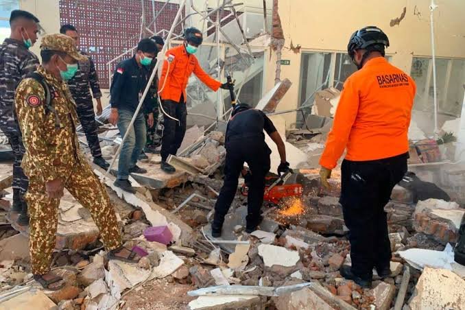
On Saturday, August 15, 2026, a powerful Indonesia magnitude 7.7 earthquake struck off the coast of Flores Island in East Nusa Tenggara province. Specifically, the shallow undersea tremor hit at 5:58 AM local time with an epicenter located roughly 68 kilometers north-northwest of Ende. Consequently, National Disaster Mitigation Agency (BNPB) officials confirmed at least 38 fatalities, 13 injuries, and widespread structural collapses across Sikka, Manggarai, and Nagekeo regencies. In addition, authorities initially issued a regional tsunami warning, but meteorologists lifted the alert three hours later after recording sea-level surges under one meter.
Landslides and Infrastructure Destruction Block Rescue Operations
In fact, the powerful shaking triggered massive landslides along the Trans-Flores Highway, severing critical road corridors between Labuan Bajo and Larantuka. As a result, emergency response crews struggled to reach remote villages near the epicenter, forcing teams to attempt sea transport via ferries. Furthermore, widespread power grid failures and telecommunications outages across eastern Indonesia hampered search-and-rescue efforts in affected municipalities.
Disaster Impact & Emergency Response Sequence
(Operational pipeline following the East Nusa Tenggara seismic event)
↓
Shallow Magnitude 7.7 Quake Strikes (5:58 AM)
(Undersea tremor at 10 km depth triggers intense ground movement across Flores Island)
↓
Coastal Tsunami Alert & Mass Evacuations
(Authorities order beach evacuations; ~2,000 residents flee to high-ground shelters)
↓
Landslides Cut Off Trans-Flores Highway
(Debris buries mountain roads and structures, including 16 bodies recovered in Reok village)
↓
Emergency Air Support & Hospital Evacuations
(Disaster agencies deploy helicopters and set up outdoor medical triage centers)
Meanwhile, medical personnel at Regional General Hospital in Maumere evacuated dozens of patients to outdoor tents after structural cracks damaged interior wards.
“Thirty-eight people have been confirmed dead, two were seriously injured, 11 sustained minor injuries, and approximately 2,000 people have evacuated on their own.”
— Lt. Gen. Suharyanto, Head of Indonesia’s National Disaster Mitigation Agency (BNPB)
Multi-Island Logistics and Disaster Relief Mobilization
Indeed, President Prabowo Subianto directed national emergency agencies to deploy military transport aircraft and rescue vessels to support island logistics. In addition, rescue crews continue searching for missing villagers trapped beneath mudslides in Ende and West Manggarai. Ultimately, risk management teams remain on high alert as dozens of strong aftershocks continue to shake the region.
| Incident Parameter / Metric | Operational Status & Disaster Details |
| Focus Keyword | Indonesia Magnitude 7.7 Earthquake. |
| Date & Time | Saturday, August 15, 2026 (5:58 AM local time). |
| Magnitude & Depth | 7.7 Magnitude at a shallow depth of 10 km. |
| Confirmed Casualties | 38 dead, 2 seriously injured, 11 minor injuries. |
| Primary Hazards | Landslides, collapsed buildings, power outages, highway blockages. |
| Tsunami Alert Status | Issued for 4 provinces; officially lifted after minor <1m waves. |
Sources
- WBHM / AP News – Magnitude 7.7 earthquake strikes off Indonesia’s coast, killing at least 38
- Rediff News – 7.7 magnitude earthquake kills at least 38 in Indonesia
- Times of India – 7.7 magnitude earthquake hits Indonesia: 38 killed, buildings collapse
- Antara News – East Nusa Tenggara’s quake death toll rises to 38, BNPB says



More